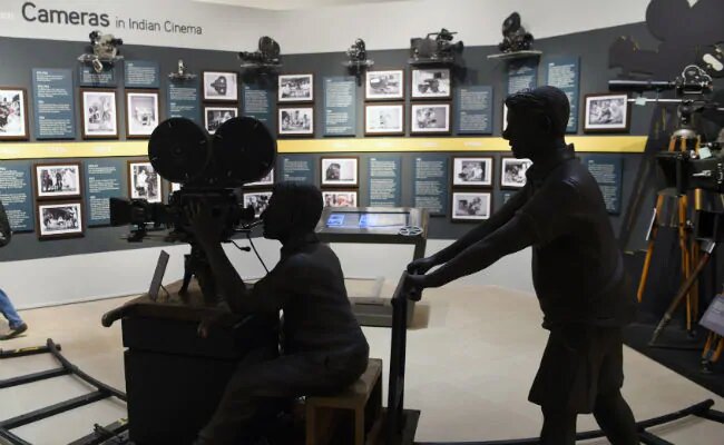
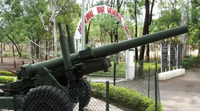
Maps Tilak Map[three_fourths_last] Your location [/three_fourths_last] Read more Museums National Film Archives MuseumNational Film Archives Museum is situated in the heart of the city Central Pune district of Maharashtra State. Founded in Read more Museums National War MuseumThe Detroit of India, Pensioner’s Paradise, Oxford of the East and the cultural capital of Maharashtra, Pune is marked by Read more Museums Mahatma Phule MuseumThe museum contains sections that contain pictures, charts, models and machines and science models. The displays are related to industry Read more Museums Dr. Babasaheb Ambedkar MuseumDr. Babasaheb Ambedkar Museum is one of the most popular and sought-after places in Pune. This museum has been set in Read more Museums Joshi's Museum of Miniature RailwayIn the Kothrud area of Pune, India, is located a small factory: Soudamini Instruments, where a special hall 26′ x Read moreMaps INS Vikrant MapYour location Read moreMaps Nagpur Central MapYour location Read moreMaps Celebrity Wax mapYour location Read moreMaps Tank MapYour location Read moreNext →← Previous
Museums National Film Archives MuseumNational Film Archives Museum is situated in the heart of the city Central Pune district of Maharashtra State. Founded in Read more Museums National War MuseumThe Detroit of India, Pensioner’s Paradise, Oxford of the East and the cultural capital of Maharashtra, Pune is marked by Read more Museums Mahatma Phule MuseumThe museum contains sections that contain pictures, charts, models and machines and science models. The displays are related to industry Read more Museums Dr. Babasaheb Ambedkar MuseumDr. Babasaheb Ambedkar Museum is one of the most popular and sought-after places in Pune. This museum has been set in Read more Museums Joshi's Museum of Miniature RailwayIn the Kothrud area of Pune, India, is located a small factory: Soudamini Instruments, where a special hall 26′ x Read moreMaps INS Vikrant MapYour location Read moreMaps Nagpur Central MapYour location Read moreMaps Celebrity Wax mapYour location Read moreMaps Tank MapYour location Read moreNext →← Previous
Museums National War MuseumThe Detroit of India, Pensioner’s Paradise, Oxford of the East and the cultural capital of Maharashtra, Pune is marked by Read more Museums Mahatma Phule MuseumThe museum contains sections that contain pictures, charts, models and machines and science models. The displays are related to industry Read more Museums Dr. Babasaheb Ambedkar MuseumDr. Babasaheb Ambedkar Museum is one of the most popular and sought-after places in Pune. This museum has been set in Read more Museums Joshi's Museum of Miniature RailwayIn the Kothrud area of Pune, India, is located a small factory: Soudamini Instruments, where a special hall 26′ x Read moreMaps INS Vikrant MapYour location Read moreMaps Nagpur Central MapYour location Read moreMaps Celebrity Wax mapYour location Read moreMaps Tank MapYour location Read moreNext →← Previous
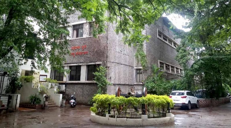
Museums Mahatma Phule MuseumThe museum contains sections that contain pictures, charts, models and machines and science models. The displays are related to industry Read more Museums Dr. Babasaheb Ambedkar MuseumDr. Babasaheb Ambedkar Museum is one of the most popular and sought-after places in Pune. This museum has been set in Read more Museums Joshi's Museum of Miniature RailwayIn the Kothrud area of Pune, India, is located a small factory: Soudamini Instruments, where a special hall 26′ x Read moreMaps INS Vikrant MapYour location Read moreMaps Nagpur Central MapYour location Read moreMaps Celebrity Wax mapYour location Read moreMaps Tank MapYour location Read moreNext →← Previous
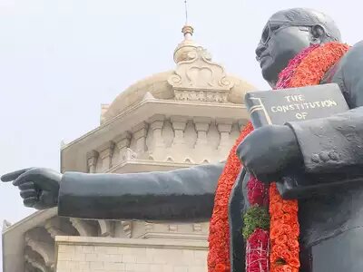
Museums Dr. Babasaheb Ambedkar MuseumDr. Babasaheb Ambedkar Museum is one of the most popular and sought-after places in Pune. This museum has been set in Read more Museums Joshi's Museum of Miniature RailwayIn the Kothrud area of Pune, India, is located a small factory: Soudamini Instruments, where a special hall 26′ x Read moreMaps INS Vikrant MapYour location Read moreMaps Nagpur Central MapYour location Read moreMaps Celebrity Wax mapYour location Read moreMaps Tank MapYour location Read moreNext →← Previous
Museums Joshi's Museum of Miniature RailwayIn the Kothrud area of Pune, India, is located a small factory: Soudamini Instruments, where a special hall 26′ x Read moreMaps INS Vikrant MapYour location Read moreMaps Nagpur Central MapYour location Read moreMaps Celebrity Wax mapYour location Read moreMaps Tank MapYour location Read moreNext →← Previous
Maps INS Vikrant MapYour location Read moreMaps Nagpur Central MapYour location Read moreMaps Celebrity Wax mapYour location Read moreMaps Tank MapYour location Read moreNext →← Previous
Maps Nagpur Central MapYour location Read moreMaps Celebrity Wax mapYour location Read moreMaps Tank MapYour location Read moreNext →← Previous